|
|
|||||||||||||
Wayne I. Anderson |
||
 |
||
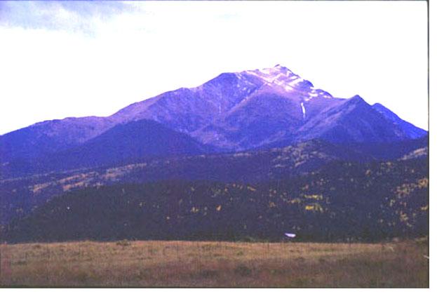
Spread Eagle Peak is underlain by a major thrust fault, one on many such offsets in the Sangre de Cristo Range. |
||
The word "fault", as commonly used, refers to a defect or imperfection. In contrast, a "fault" in geology describes a surface or zone within rocks or sediments along which there has been some displacement. Faulting formed the magnificent Sangre de Cristo Mountains. If the local area was without faults geologically speaking, it would be devoid of its rugged character and scenic splendor. The Sangre de Cristo Range, originally considered to be a large anticlinal structure (upfolded region), is now known to be more complex. The structure of the Sangres includes low-angle faults that functioned as thrust faults during Laramide deformation when the modern Rockies were laterally compressed during Late Mesozoic to Early Tertiary time, approximately 65 million years ago to 60 million years. This strong lateral compression produced a fold-thrust belt that extends the length of the Sangre de Cristo Range. Structural geologists recognize four major Laramide thrust zones or folded terrains within the Sangres. Hoy and Ridgway (2002) present evidence that the structural configuration of the Pennsylvanian-Permian formations exposed at high elevations in the northern Sangre de Cristo Range is the result of several stages of deformation. They contend that some of the east-west shortening, folding, and thrust faulting dates to Late Paleozoic time. During mid-Cenozoic time (approximately 35 million years ago to 20 million years ago), the bordering fault systems of the Sangres (Alvarado fault zone on the east and Sangre de Cristo fault zone on the west) were reactivated, and the range and its associated thrust zones and folded terrains was uplifted as a large block (horst). The San Luis Valley to the west of the Sangres and the Wet Mountain Valley to the east formed where large blocks (grabens) dropped downward along faults. Graben formation was coincident with major regional rifting in northern New Mexico and southern Colorado known as Rio Grande rifting. Rifting was accompanied and followed by a variety of igneous intrusions, lava flows, and ejections of volcanic ash. The Alvarado fault is a complex fault zone with at least two periods of movement (Laramide and post-Laramide). Exposed segments of the fault zone such as up slope from the Alvarado campground and near North Taylor Creek are interpreted as an eastward-dipping thrust. The Laramide thrusting brought Precambrian gneiss on the east side of the fault zone over Sangre de Cristo Formation sandstones and conglomerates on the west side of the fault system. Later, a zone of post-Laramide normal faulting took place in the same general area, along the east flank of the Sangres. This fault zone, with several thousand feet of displacement, is now buried beneath younger Quaternary deposits (sediments of the last two million years). On the west side of the Sangre de Cristo Range, the Sangre de Cristo Fault Zone is also part of a complex system where Laramide thrusting was followed by younger normal faulting. This normal fault system separates the Sangre de Cristo Range from the San Luis Valley on the west. It also marks the eastern boundary of the Rio Grande Rift Zone. Displaced sediment layers in alluvial fans along the west flank of the Sangres demonstrate that some faulting there took place in post-glacial times as recently as 7,500 to 7,800 years ago. Detailed studies along the Sangre de Cristo Fault document as many as 13 displacements in roughly the past 400,000 years with offsets of approximately five to seven feet per event. However, the Alvarado normal fault system, bordering the east side of the Sangres, shows no displacement of post-glacial sediments, indicating that the eastern flank of the range has been stable for some time. A map showing the generalized geologic setting of the northern Sangre de Cristo Range is shown below (figure 1). Note the location of the bordering faults (Sangre de Cristo fault on the west and Alvarado fault on the east). In addition, major thrust faults or zones within the Sangres are shown with a barbed pattern. The Wet Mountain Valley graben is bordered on the west by the Alvarado normal fault and on the east by the Westcliffe normal fault system. Note also that the Wet Mountain Uplift is bordered by faults on the east and west. In addition, the Precambrian bedrock of the Wet Mountain Uplift is cut by the northwest-southeast trending Ilse Fault. A representative west-east geologic cross section of the Sangres (figure 2) is also shown, depicting major faults within the range. |
|
 |
||
Figure 1. Map showing geologic setting and major faults of the northern Sangre de Cristo Range. Adapted from Tweto, 1979 and Lindsey et al., 1986. |
||
 |
||
Figure 2. Geologic cross section showing structural positions of major rock units in the northern Sangre de Cristo Range. West (left) to east (right) cross section from the San Luis Valley near Crestone to the Wet Mountain Valley, east of Horn Peak. Yqm and Xgn are symbols for Precambrian rocks. Pm refers to the Minturn Formation. pPss and pPsc designate sandstones and conglomerates of the Sangre de Cristo Formation. MDO indicates Lower and Middle Paleozoic rock units exposed along fault slices. QTs refers to Quaternary and Tertiary sediments. Adapted from Lindsey et al., 1986. |
||
References Hoy, R.G., and Ridgway, K.D. 2002. "Syndepositional thrust-related deformation and sedimentation in an Ancestral Rocky Mountains basin, Central Colorado trough, Colorado USA." Geological Society of America Bulletin. v. 114, p. 804-828. Lindsey, D. A., Andriessen, P. A. M. , and Wardlaw, B. R.. 1986. "Heating, cooling, and uplift during Tertiary time, northern Sangre de Cristo Range, Colorado." Geological Society of America Bulletin. v. 97, p.1133-1143. McCalpin, J. P. 1987. "Recurrent Quaternary normal faulting at Major Creek, Colorado: An example of youthful tectonism on the eastern boundary of the Rio Grand Rift Zone." Geological Society of America Centennial Field Guide--Rocky Mountain Section, p. 353 356, Geological Society of America, Boulder, Colorado. Tweto, Ogden. 1979. Geologic Map of Colorado. U. S. Geological Survey.
|
|
 |
 |
 |
||||